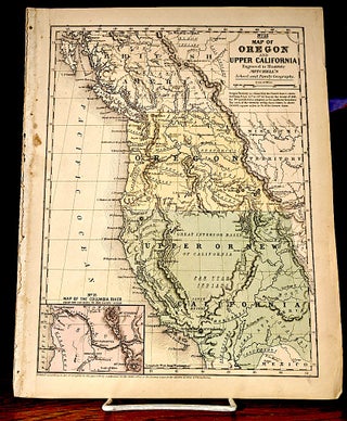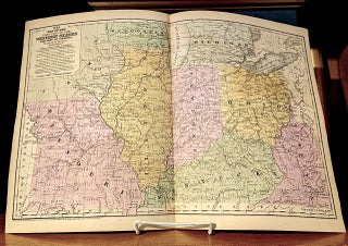
Map of the Chief Part of the Western States and Part of Virginia. Engraved to Illustrate Mitchells "School and Family Geography".
Conetticut: S. Augustus Mitchell, 1839. Image size / 10-1/2"x16-1/4", source / Mitchell's School and Family Geography, hand coulored. -- Mitchell began publication of his school atlas in 1839. This work and variant editions for older and younger students, was issued by Mitchell and his successors from 1839 to 1886. "Samuel..... More

![Item #10714 New Jersey Reduced From T. Gordon's Map [1834] by H. S. Tanner 1841; From:...](https://lonesomewaterbooks.cdn.bibliopolis.com/pictures/10714.jpg?width=320&height=427&fit=bounds&auto=webp&v=1708297458)
![Item #10404 [Map] Plan de la Ville et du Port d'Ancone. Voyage en Italie Tome VIII. Pl. 1. No. 2....](https://lonesomewaterbooks.cdn.bibliopolis.com/pictures/10404.jpg?width=320&height=427&fit=bounds&auto=webp&v=1639378969)