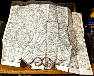
A NEW MAP OF PENNSYLVANIA with its CANALS, RAIL-ROADS & DISTANCES from PLACE to PLACE along the Stage Roads
H. S. Tanner, 1840. Entered according to Act of Congress in the year 1840, by H. S. Tanner in the clerks office of the eastern district of Pennsylvania. -- Border is 14" wide x 11". -- Framed and matted. More
![Item #10714 New Jersey Reduced From T. Gordon's Map [1834] by H. S. Tanner 1841; From:...](https://lonesomewaterbooks.cdn.bibliopolis.com/pictures/10714.jpg?width=320&height=427&fit=bounds&auto=webp&v=1708297458)